Note: This article pertaining to Are the Real Geographic Centers of the United States Incorrectly Marked? was originally published on Monday, July 31, 2017 at 11:46 in the morning and has been updated.
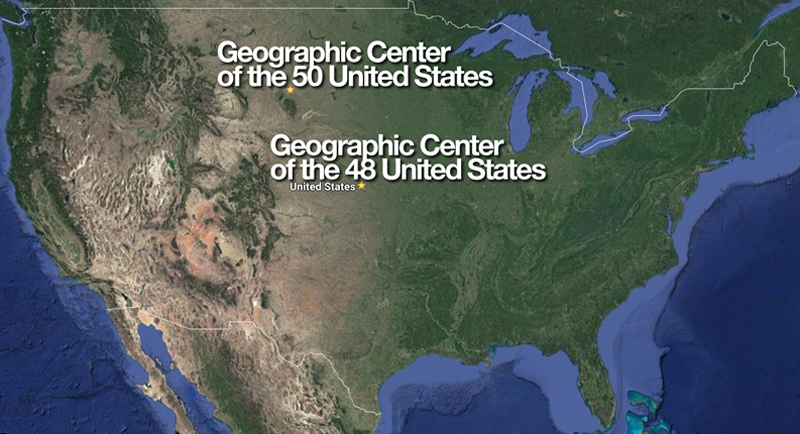
“When Hawaii became a U.S. state in 1959, there was a need to reconfigure calculations to find the new center of the entire country. The new spot was pinpointed near Belle Fourche, South Dakota, and marked with a pole driven into the farmland”, according to this article pertaining to 11 geographic markers that are totally inaccurate as written by Kavya Ram Mohan of Atlas Obscura. “This seemed like a somewhat weak way to honor the very middle of the United States, so the city, a little over 20 miles south of the makeshift marker, decided to do it up right. In 2008, they installed a large granite compass rose and dubbed it the ‘Center of the Nation’ monument. There is even a metal disc in the middle that looks like an official geographic marker (though the official spot is to the north) for people to stand on and snap photos.”
Are the Real Geographic Centers of the United States Incorrectly Marked?
Several years prior to 2008 — while I was on a business trip to Spearfish — I drove almost 13 miles north on United States Highway 85 to Belle Fourche so that I may drive further north to visit the geographic center of the 50 United States, which is located within twelve miles of the Wyoming border…
…but when I arrived near the exact spot, I could not find it. No signage was available. The experience was as though the spot did not exist.
Confused, I eventually found a law enforcement officer and asked about where I could find the geographic center of the 50 United States. He replied that visiting the exact spot was not possible: “It is located over there,” he said as he pointed to a large field with tall weeds. “A lot of people have been bitten by snakes there; so we do not encourage anyone to go there at this time.”
“Snakes?!?” I said, incredulously.
“Yep,” he confirmed.
I found that bizarre — although he hinted that Belle Fourche might create a more hospitable environment for visitors to be at the spot where the geographic center of the 50 United States is located.
Apparently, they are still not close enough to the exact spot. Must be those durn snakes — if what the police officer told me was accurate.
The Geographic Center of the 48 Contiguous United States
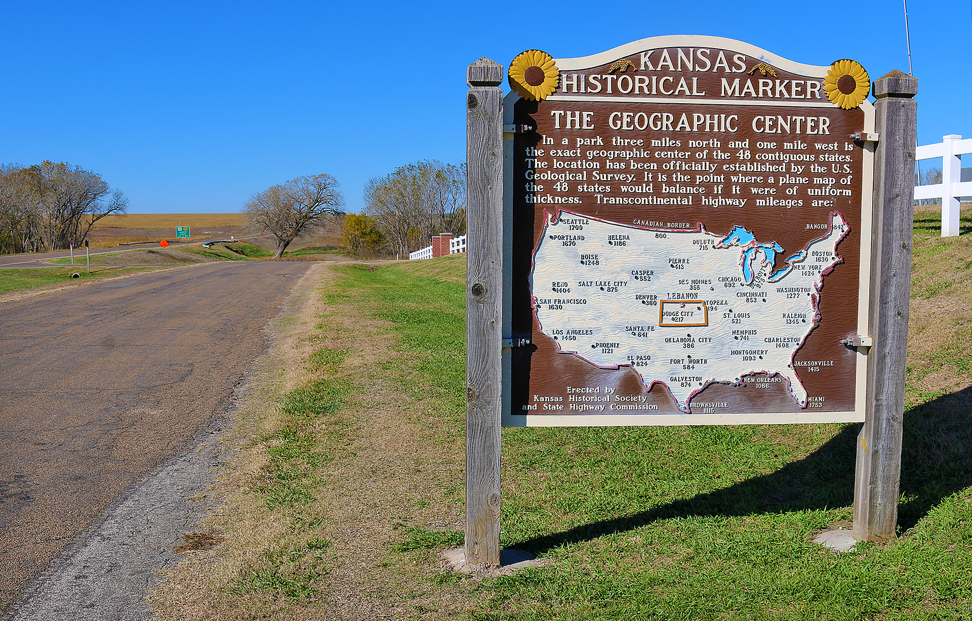
I have twice been to the geographic center of the 48 contiguous United States, which is located approximately two miles northwest of Lebanon. The first time I was there was when I had finished with business in that hotbed of excitement known as Hays in western Kansas; and I headed east on Interstate 70 for the drive of approximately four hours back to Kansas City to catch a flight. Wheat, corn and sunflowers as far as the eye can see gets boring for just about anyone after 30 minutes — let alone four hours — so I fortunately found out about the geographic center of the 48 contiguous United States in this somewhat hilly part of Kansas near its border with Nebraska…
…but what I did not know is that — according to the aforementioned article — this location was also inaccurate:
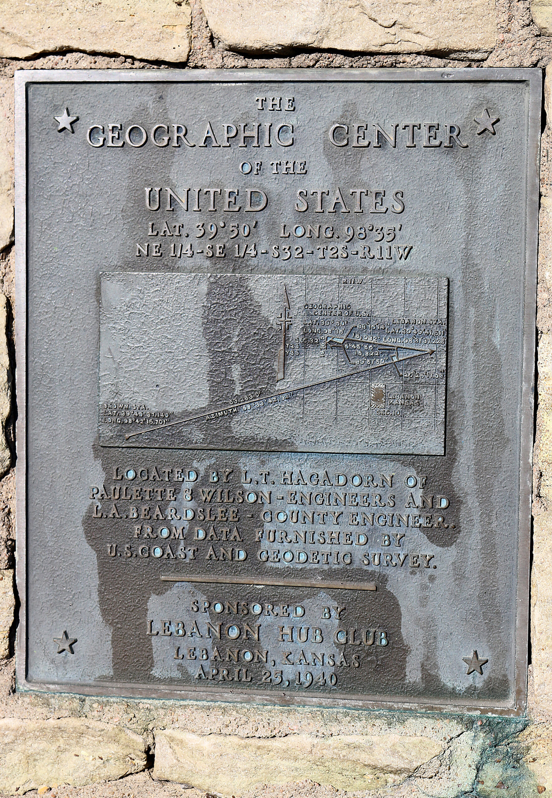
“The geographic center of the contiguous United States is marked at a point about two miles northwest of Lebanon, Kansas. A small stone pyramid designates the spot measured by a survey performed in 1918. A picnic table and cozy chapel are nearby. Couples can be married at the chapel and a Bible and guestbook allow visitors to reflect and mark their attendance to the middle of America.
The problem is, the actual center determined by the 1918 survey is located on a private farm less than a mile away. And in a second plot twist, a new location was later determined in Agra, Kansas, nearly 28 miles away.”
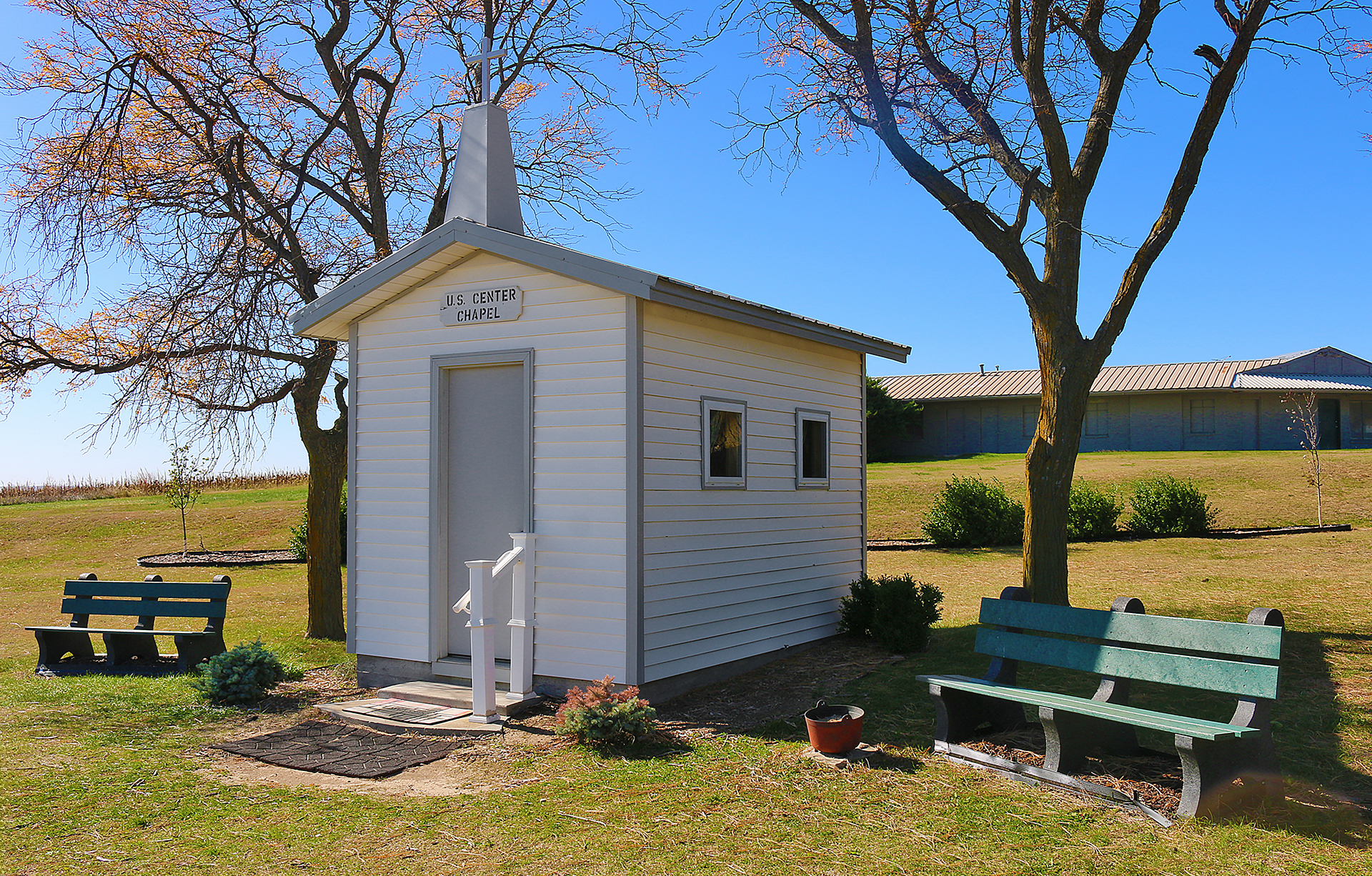
I signed the guest book in that tiny little chapel; and I sat at the picnic table as well as the bench next to the official monument: a pyramidal stone structure sporting a commemorative plaque and topped with a flagpole upon which the flags of the United States and the state of Kansas both flap continuously in the wind, loudly and proudly.
I contemplated seeing more wheat, corn and sunflowers during the remainder of my journey as I stared to the east at a rickety old wooden sign across AA Road proclaiming Welcome to the Center of the USA — while advertising at the bottom that the town of Lebanon has souvenirs — and beyond as Kansas State Highway 191 gradually disappeared into the horizon of gently rolling green hills, sporadically peppered with a building or two and a dozen or so trees.
While I was there, I did not see another visitor at this lonely triangle in what appears to be the middle of nowhere, far from any ocean in this double-landlocked state.
Final Boarding Call
Unfortunately, I did not have a camera with me while I visited the geographic centers of the 50 United States in South Dakota — I was traveling on business at that time, so I did not have a camera with me; and The Gate With Brian Cohen did not yet exist — but I did take photographs of the second time I visited the geographic center of the 48 United States in Kansas.
Perhaps one day I will go back to both centers of the United States and get to the real exact points once and for all — as well as the geographic center of North America in North Dakota — although with my luck, they may eventually drift yet again due to the shifting of land…
All photographs ©2017 by Brian Cohen.
