
Due to the effects of Tropical Storm Ernesto affecting the Leeward Islands August 2024, you may want to consider delaying your travel — or, at least, keep yourself updated as to the latest information pertaining to the weather — if this region is in your travel plans over the next few days.
Tropical Storm Ernesto Affecting the Leeward Islands: August 2024 Travel Alert
Maximum sustained winds of Tropical Storm Ernesto — which is currently approximately 165 miles east southeast of Antigua and moving west at a speed of 25 miles per hour — are at 40 miles per hour, which means that it is currently a weak tropical storm. A possible landfall of this tropical storm could occur somewhere in Guadeloupe as soon as the early hours of the morning tomorrow, Tuesday, August 13, 2024; and a landfall is more likely to occur on the southern coast of Puerto Rico as soon as the late hours of the evening tomorrow, Tuesday, August 13, 2024.
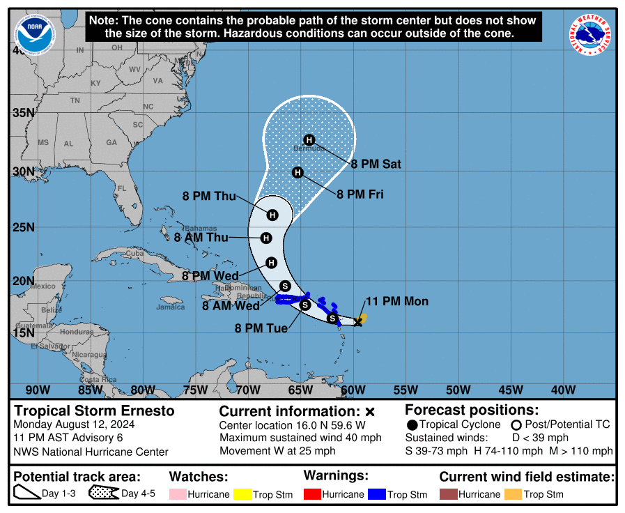
The forward movement of this tropical storm could reduce the effects of the impact of the storm, as it will not have as much time to cause more damage to the affected areas. After leaving Puerto Rico, Tropical Storm Ernesto could strengthen to hurricane status as it heads towards Bermuda.
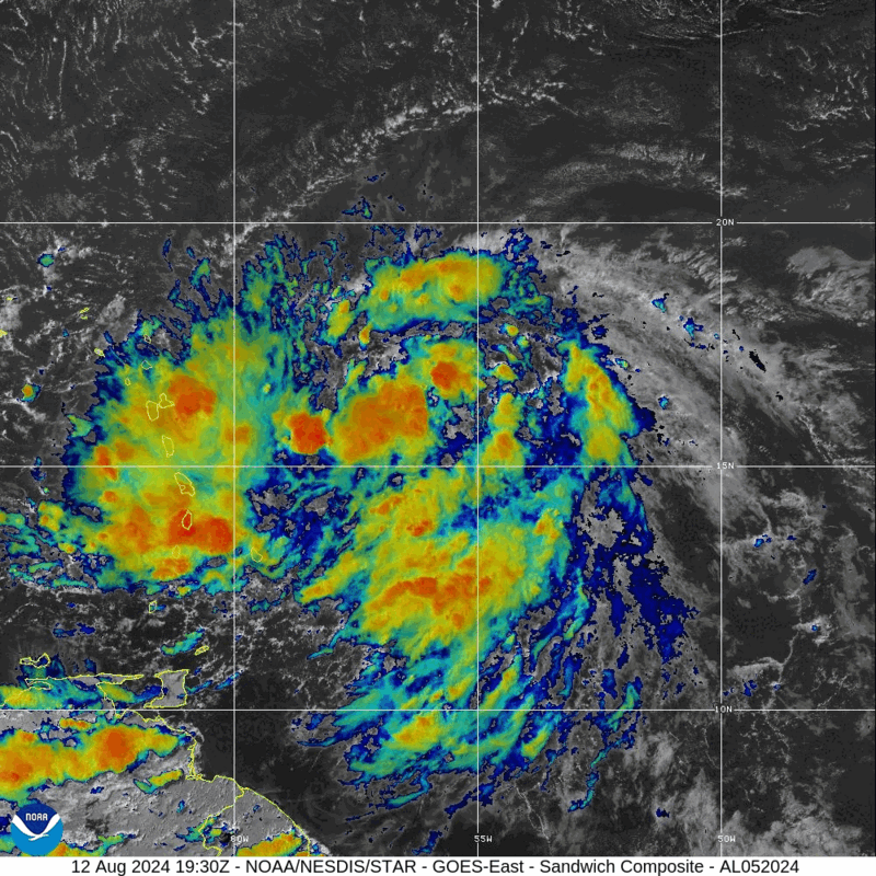
The outermost bands of this tropical storm are already currently affecting portions of the Leeward Islands.
A Tropical Storm Warning is in effect for:
- Saint Kitts
- Nevis
- Montserrat
- Antigua
- Barbuda
- Anguilla
- Guadeloupe
- Saint Martin and Saint Barthelemy
- Sint Maarten
- British Virgin Islands
- United States Virgin Islands
- Puerto Rico
- Vieques
- Culebra
Significant precipitation of up to ten inches is possible in across portions of the Leeward Islands and the Virgin Islands, which is expected to result in considerable urban flooding and flash flooding.
Rough surf and strong rip currents are currently affecting many parts of the Leeward Islands. A storm surge of as high as three feet above normal is expected to contribute to the aforementioned significant flooding of portions of the eastern coast of Puerto Rico from San Juan to Guayama — including the islands of Culebra and Vieques; and in the United States Virgin Islands — including Saint Thomas, Saint John, and Saint Croix.
Expect windy conditions to occur over much of the Leeward Islands.
Flight Waivers, Delays, and Cancellations
If you are traveling to or from the Leeward Islands in the Caribbean region, expect delays and cancellations of flights. Keep up to date on the latest information pertaining to this tropical weather system which may adversely affect your travel plans. Better yet, postponing or canceling your trip might be a better option — no matter which mode of travel you plan on taking.
If you have a flight scheduled, your flight may be delayed or canceled — and you may be eligible for a waiver of a fee to change your itinerary. If you are driving in any of these areas, watch out for deteriorating weather conditions and traffic problems.

Here are nine airlines which have issued travel alerts as a result of this tropical weather system:
- American Airlines has issued travel alerts for twelve airports in nine countries and territories for Tuesday, August 13, 2024 through Wednesday, August 14, 2024; and Monday, August 19, 2024 is the last day on which tickets must be reissued and rebooked travel must begin.
- Delta Air Lines has issued travel alerts for Punta Cana, San Juan, Sint Maarten, and Saint Thomas for Tuesday, August 13, 2024 through Thursday, August 15, 2024; and Sunday, August 18, 2024 is the last day on which tickets must be reissued and rebooked travel must begin.
- United Airlines has issued travel alerts for Aguadilla, San Juan, and Saint Thomas for Monday, August 12, 2024 through Thursday, August 15, 2024; and Thursday, August 22, 2024 is the last day on which tickets must be reissued and rebooked travel must begin.
- Southwest Airlines has issued travel alerts for Punta Cana and San Juan for Tuesday, August 13, 2024 through Wednesday, August 14, 2024; and Wednesday, August 28, 2024 is the last day on which tickets must be reissued and rebooked travel must begin.
- JetBlue Airways has issued travel alerts for nine airports in five countries and territories for Tuesday, August 13, 2024 through Wednesday, August 14, 2024; and Wednesday, August 21, 2024 is the last day on which tickets must be reissued and rebooked travel must begin.
- Frontier Airlines has issued travel alerts for nine airports in three countries and territories for Tuesday, August 13, 2024 through Thursday, August 15, 2024.
- Spirit Airlines has issued travel alerts for San Juan, Saint Croix, Sint Maarten, and Saint Thomas for Tuesday, August 13, 2024 through Wednesday, August 14, 2024; and Monday, August 19, 2024 is the last day on which tickets must be reissued and rebooked travel must begin
- Silver Airways has issued travel alerts for six airports in four countries and territories for Monday, August 12, 2024 through Thursday, August 15, 2024; and Tuesday, August 20, 2024 is the last day on which tickets must be reissued and rebooked travel must begin.
- KLM Royal Dutch Airlines has issued travel alerts for Punta Cana, San Juan, Sint Maarten, and Saint Thomas for Tuesday, August 13, 2024 through Thursday, August 15, 2024; and Sunday, August 18, 2024 is the last day on which tickets must be reissued and rebooked travel must begin.
Final Boarding Call
Do not be surprised if additional airlines issue travel waivers or alerts.
Be sure to contact your airline or transportation provider for the latest information pertaining to your travels — if they are adversely affected — and please: travel safely.
Source: The National Oceanic and Atmospheric Administration of the Department of Commerce of the United States.
