
Note: This article pertaining to 13 of the Most Fascinating International Borders in the World was originally published on Friday, July 14, 2017 at 11:18 in the evening and has been updated.
Borders usually clearly delineate two entities apart — whether they be towns, cities, states, countries or continents — but some borders around the world seemingly inexplicably create some interesting anomalies which one would not normally find or expect.
13 of the Most Fascinating International Borders in the World
Not all international borders are simple uncomplicated straight lines that divide one country from another. In reality, a political map shows what a mess are these boundaries, which are often invisible but occasionally obvious. Borders can be expressed as simply as with painted lines that divide villages — such as the line between Belgium and the Netherlands which even dissects homes and cafés — as well those borders which are elevated greater than 29,000 feet above sea level.
Without further ado, here are 13 examples of the most fascinating international borders in the world that are highlighted in this article in no particular order.
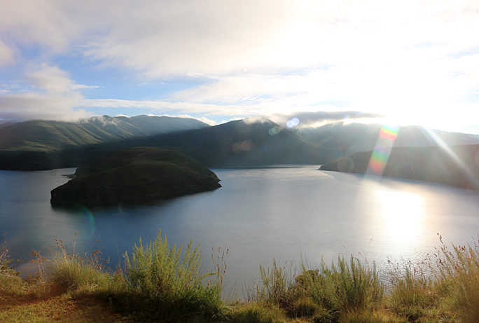
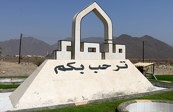
1. Fun With Enclaves and Exclaves: United Arab Emirates and Oman
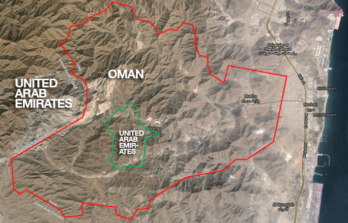

The particular enclave and exclave which I visited is where an exclave of Oman is also an enclave within the United Arab Emirates; but within that exclave of Oman is an exclave of the United Arab Emirates, which is also an enclave…
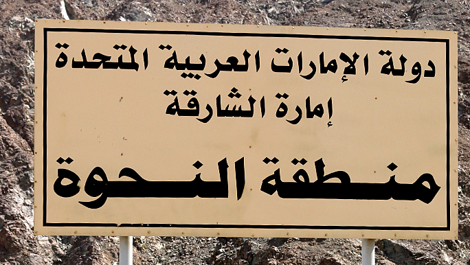

…which means that a portion — or counter-enclave — of the United Arab Emirates is located within a portion of Oman, which is located within the United Arab Emirates.

Before continuing with this article, an enclave is a portion of territory within or surrounded by a larger territory whose inhabitants are culturally or ethnically distinct; while an exclave is a portion of territory of one state completely surrounded by territory of another or others, as viewed by the home territory.
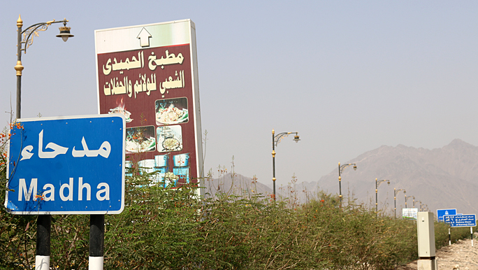

Please read this article which I wrote for more details pertaining to my experience.
2. The Land Owned by No One — and Not Wanted By Anyone
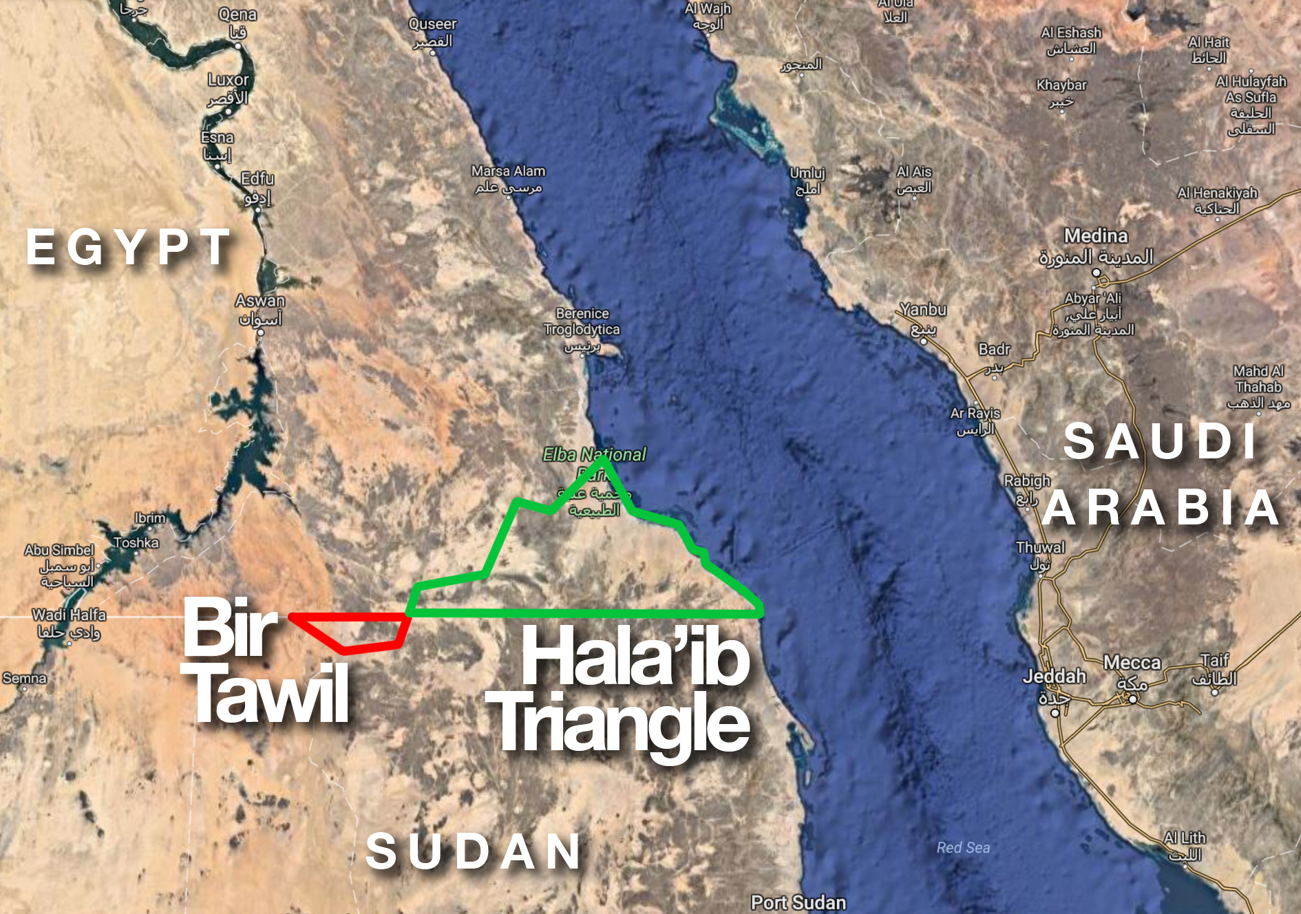

I would like to say that I have journeyed to this fabled piece of forgotten land — or, perhaps, maybe not — but alas, I have never visited the lone trapezoidal anomaly nestled south of what was supposed to be the official straight border along the 22nd parallel of Egypt and Sudan. Neither country wants to claim the barren lawless land of roughly 800 square miles known as Bir Tawil, for to do so would automatically mean the acknowledgement of relinquishing a larger, more fertile and more lucrative disputed piece of land referred to as the Hala’ib triangle, with many miles of coastline along the Red Sea.
The closest I came to Bir Tawil was a scant 275 miles to the north and slightly west in an ancient city known as Luxor — at which I experienced arguably the best service I ever received from a hotel property and near which I visited the Mortuary Temple of Hatshepsut. To try obtaining directions to Bir Tawil on Google Maps is an exercise fraught with futility, as no viable transportation option is possible.
More information on this curious piece of land is imparted in this article which I wrote in January of 2017 — as well as a comment that was posted by a person who declares himself to be the king of Bir Tawil.
3. A Wildlife Reserve — In the Unlikeliest of Places
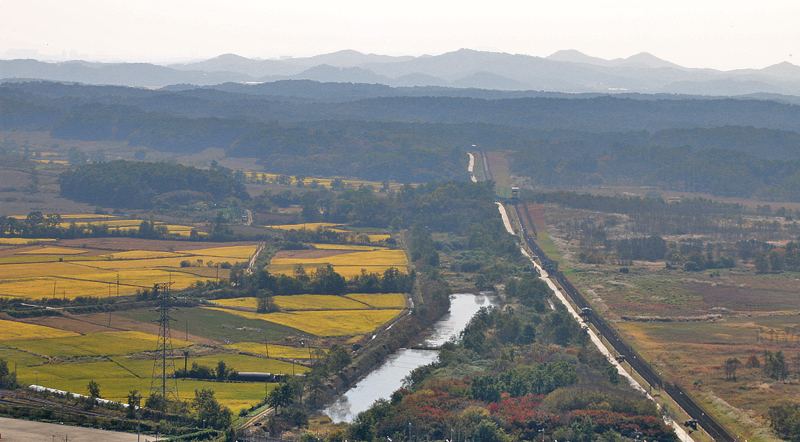

I visited the Korean Demilitarized Zone — which serves as a buffer approximately 2.5 miles wide between North Korea and South Korea — back in October of 2014, where I was technically in North Korea for a few minutes.
After its establishment almost 72 years ago on Monday, July 27, 1953, this stretch of no man’s land — whose length is approximately 155 miles — has eventually transformed into an undeveloped nature reserve which reportedly contains gorals, wild boar, roe deer, endangered cranes and even rare Siberian tigers; and both countries have cooperated to protect the rare wildlife which has flourished here.
I personally had not seen any of the aforementioned wildlife.
4. The Largest Enclave in the World
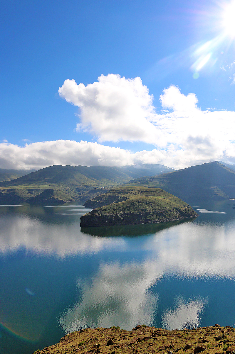

Lesotho is a kingdom comprised of approximately two million people which — at 11,720 square miles — is considered the largest enclave on earth, as it is completely surrounded by the country of South Africa. I visited Lesotho in February of 2015…
…never mind that I endured a flat tire which I had to change on my way to Lesotho as well as having to wait four hours in a thunderstorm to cross the border — along with the reason for that long wait. The possibility of being sleepless in Lesotho was quite real; but I finally managed to be in a bed in the room of the lodge which I originally reserved.
Anyway…largest enclave.
5. The Smallest Republic in the World
Lesotho is not the only independent state completely surrounded by another country. The Republic of San Marino is an enclave completely surrounded by Italy — as is Vatican City — and is considered the oldest and smallest republic in the world.
I visited Italy several times; but I never got the chance to visit neither San Marino nor Vatican City because both were out of the way and I had limited time. However, there are still places in Italy to which I have not yet been — and if I do return, I hope to visit both San Marino and Vatican City in the process.
6. An Italian Enclave — Which Is Mostly Swiss
Speaking of Italy, Campione d’Italia has a Swiss dialing code, Swiss emergency responders, and uses the Swiss Franc as currency — but this is an Italian enclave which is surrounded by Switzerland and the Lugano Prealps.
I have been to Switzerland several times — and I was near Italy the first time when I was in Montreux.
7. A Possible Quadripoint — Or Merely Two Tripoints?
The point where the states of Arizona, Colorado, New Mexico, and Utah which is known as Four Corners Monument is definitively clear — and I visited it in 2017, about which you can read in this article — but only one place on earth reportedly exists where the countries of Zambia, Namibia, Zimbabwe, and Botswana meet at a single point…
…or is it really a single point of the convergence of four different countries? A very close look at Google Maps — assuming it is accurate — suggests that Botswana separates Namibia and Zimbabwe from ever meeting by fewer than 200 meters or 650 feet somewhere near the confluence of the Chobe River with the Zambezi River. That begs the question: is this a bonafide quadripoint — or is this simply two tripoints situated very close to each other?
Of these countries, I have visited Botswana in February of 2015 — including the capital city of Gaborone in which I stayed at the Cresta President Hotel; and an interesting place called Matsieng Footprints where legend claims life began.
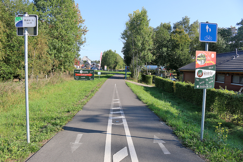
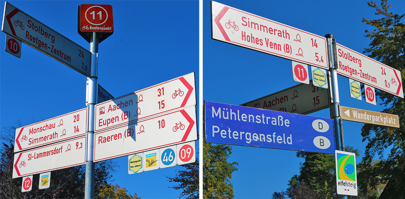
Speaking of tripoints, I visited Drielandenpunt in 2017, at which the borders of Germany, Belgium, and the Netherlands meet. That in and of itself was cool
8. Baarle Nassau in the Netherlands and Baarle Hertog in Belgium
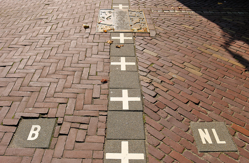
Within Baarle Hertog of the Netherlands are 22 enclaves of Belgium; and within Baarle Nassau of Belgium are eight enclaves of the Netherlands, which is why a haphazard hodgepodge of border markings exists between the two villages — and between the two countries in this area.
9. A Misplaced Lighthouse
When I visited Helsinki in 2017, I was too far away to explore this anomaly at the point where the Baltic Sea gives way to the Gulf of Bothnia called Märket. The uninhabited island was meant to be cleanly split down the middle between Finland and Sweden; but a Finnish lighthouse, which was erected on the Swedish side of Märket — when Finland was controlled by Russia — violated the border. To correct the mistake, the border across Märket now zigs and zags wildly.
10. The Island Where You Can See the Future
Little Diomede Island belongs to the United States; and it has a hardcore weather-beaten population of approximately 150 people. Big Diomede is an island which belongs to Russia and is uninhabited. The space between these two islands is approximately 2.5 miles apart — squarely in the middle of the Bering Strait — marks not only an international border, but the International Date Line as well. This means that people on Little Diomede Island can wake up on a Sunday morning, pour themselves a cup of coffee, and peer across the water to Big Diomede, where the day is Monday.
I wonder if a way exists to cross the Bering Strait between the two islands…?
11. The Tallest International Border in the World
You will need to climb the tallest mountain the in the world to trace the international border separating Nepal and the Tibet Autonomous Region, which is a part of China. This border splits Mount Everest at its summit which is approximately 29,032 feet above sea level.
Talk about getting high…
12. A Third-Order Enclave in the World — Gone Due to the Resolution of the Weirdest Border Dispute
When India and Bangladesh exchanged greater than 160 enclaves, they ended a dispute on Saturday, August 1, 2015 which had lasted almost 70 years. “The exchange between India and Bangladesh means that the world will not only lose one of its most unique borders, but it will also lose the only third-order enclave in the world — an enclave surrounded by an enclave surrounded by an enclave surrounded by another state”, according to this article written by Adam Taylor of The Washington Post. “It’s confusing, so let me spell it out: Dahala Khagrabari, the third-order enclave in question, was a part of India, surrounded by a Bangladeshi enclave, which was surrounded by an Indian enclave, which was surrounded by Bangladesh.”
The article contains a map which should help to clarify the area where the third-order enclave once existed.
13. The Vennbahn: A Former Railway
The Vennbahn is a former German railway line; but it became part of Belgium after the Treaty of Versailles — even in several areas which are supposed to be part of Germany. This resulted in the creation of six German exclaves — as well as one Belgian enclave inside a three-way intersection of roads in Germany.
Final Boarding Call
Travel is filled with many interesting aspects — including anomalies pertaining to borders, which can give an insight into the region which you are visiting.
I am interested in reading your experiences pertaining to fascinating borders of the world — international or otherwise — or at least ones which interest you enough to perhaps want to visit in the future.
All photographs ©2014, ©2015, and ©2018 by Brian Cohen.
