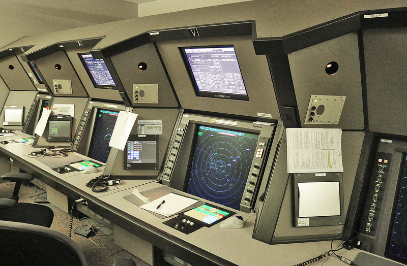
“Hi!” was the enthusiastic greeting by a man garbed in jeans and a T-shirt as he turned around away from the monitors and noticed that there were visitors in the darkened round room where approximately a dozen other people were quietly working away…
Air Traffic Control: Behind the Scenes at Atlanta A80 Terminal Radar Approach Control Facility
…but do not be fooled: working as an air traffic controller for the Federal Aviation Administration of the Department of Transportation of the United States is far removed from being a relaxing job. In fact, the profession is one of the most stressful, with its irregular hours and mandatory attention to detail required virtually every second of the day to ensure that thousands of passengers and members of flight crews are transported safely every day.
The mandatory retirement age for air traffic controllers is 56 years old.
Although no airplane can be seen for miles, the Atlanta A80 Terminal Radar Approach Control Facility in Peachtree City is the nerve center of greater than 200 airports in the southeastern United States — including the busiest airport in the world which serves the greater Atlanta metropolitan area — as well as those airports which serve Macon, Columbus and Athens in Georgia; local airports in counties such as Cobb, DeKalb and Fulton; heliports; and military airports such as Warner Robins and Dobbins Air Reserve bases.
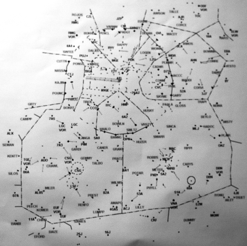
This paper map shows the area for which the Atlanta A80 Terminal Radar Approach Control Facility is responsible. Just above the center is the airport which serves Atlanta; while the airports which serve Columbus and Macon are at the bottom; and the airport which serves Athens is at the upper right portion of the map.
Memorable Responsibilities
Air traffic controllers must have excellent memories in order to conduct safe departure and arrival operations for literally thousands of flights at airports throughout the United States: what are the elevations and terrain surrounding the airport? How closely can you slot in as many airplanes into a queue for landing as possible without compromising safety?
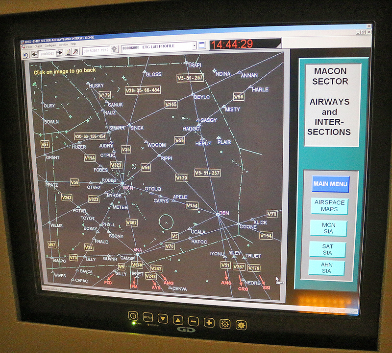
What do all of the symbols and abbreviations on the monitors mean? For example, this is a radar mapping of the airways and intersections of the Macon sector.
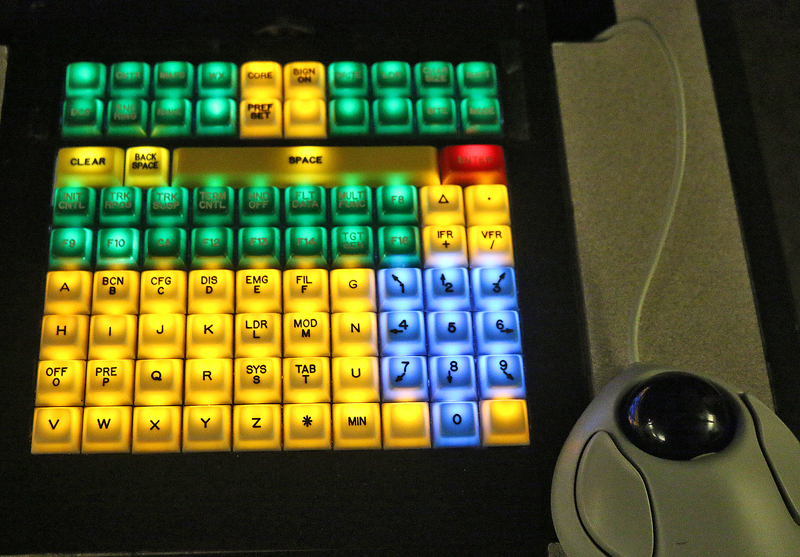
Just as important: how do you operate a plethora of equipment and technology — some of which may be as much as 50 years old?
The answers to all of those questions — and more — must be memorized by the air traffic controllers, who must remain flexible in fluid situations should they arise; and must immediately respond as appropriately and as accurately as possible in the event of an emergency.
Depending on their sizes, airplanes can be placed in a queue as few as four nautical miles; but to avoid such hazards as wake turbulence, a regional jet aircraft may be slotted in no closer than six nautical miles behind a large aircraft — such as a Boeing 777-200LR airplane. In the case of an Airbus A380 aircraft, the minimum trailing distance may be as much as eight nautical miles.
When an airplane is located in a “non-active” area of the airport — such as at the gate or on the tarmac — it is under the control of the airline and not of the Terminal Radar Approach Control Facility.
An Emergency Situation Unfolds
“Fuel leak, left cowl” is what I overheard one of the air traffic controllers calmly repeating while talking into his microphone during what was an apparent emergency situation: the airplane whose name, ground speed in knots and altitude were in white but a code above them in an obvious red slowly approached the airport, pixel by pixel on the radar screen.
This emergency would be successfully handled by a joint effort between the air traffic controller and the pilots, with the passengers aboard the airplane none the wiser.
Meanwhile, inclement weather starts to show up on the radar as it approaches from the west. Airplane traffic is directed southwest of the airport to dodge the storms, as pilots prefer not to fly through the storms. Delays could result should there be too much traffic funneling through the area south of the storms.
Training
Several seats away, a different air traffic controller was shadowed by another person, as he was not completely certified yet to operate by himself. Hopefully, he will join the understaffed team as soon as possible to be on his own, as only 68 employees currently form the team of what are supposed to be 100 air traffic controllers — but despite the need for additional air traffic controllers, trainees must meet all certification criteria in order to join the team on their own; and if not within a specific time period, they are assigned elsewhere.

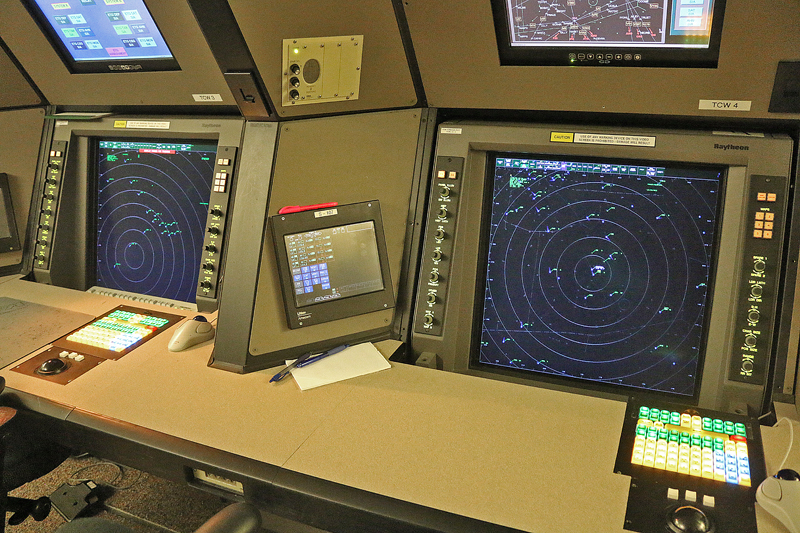
Photographs are expressly forbidden in much of the facility other than in the training room — which was fortunately empty during my visit — due to the sensitive nature of ensuring that the air traffic controllers remain as undisturbed as possible while performing their responsibilities; but the training room is a full-scale mock-up containing equipment and simulators which are identical to what is used in the control center of the facility.
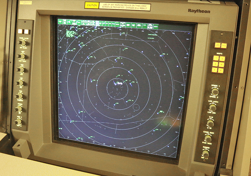
Air traffic controllers mostly use the Automated Radar Terminal System or the Standard Terminal Automation Replacement System to track aircraft.
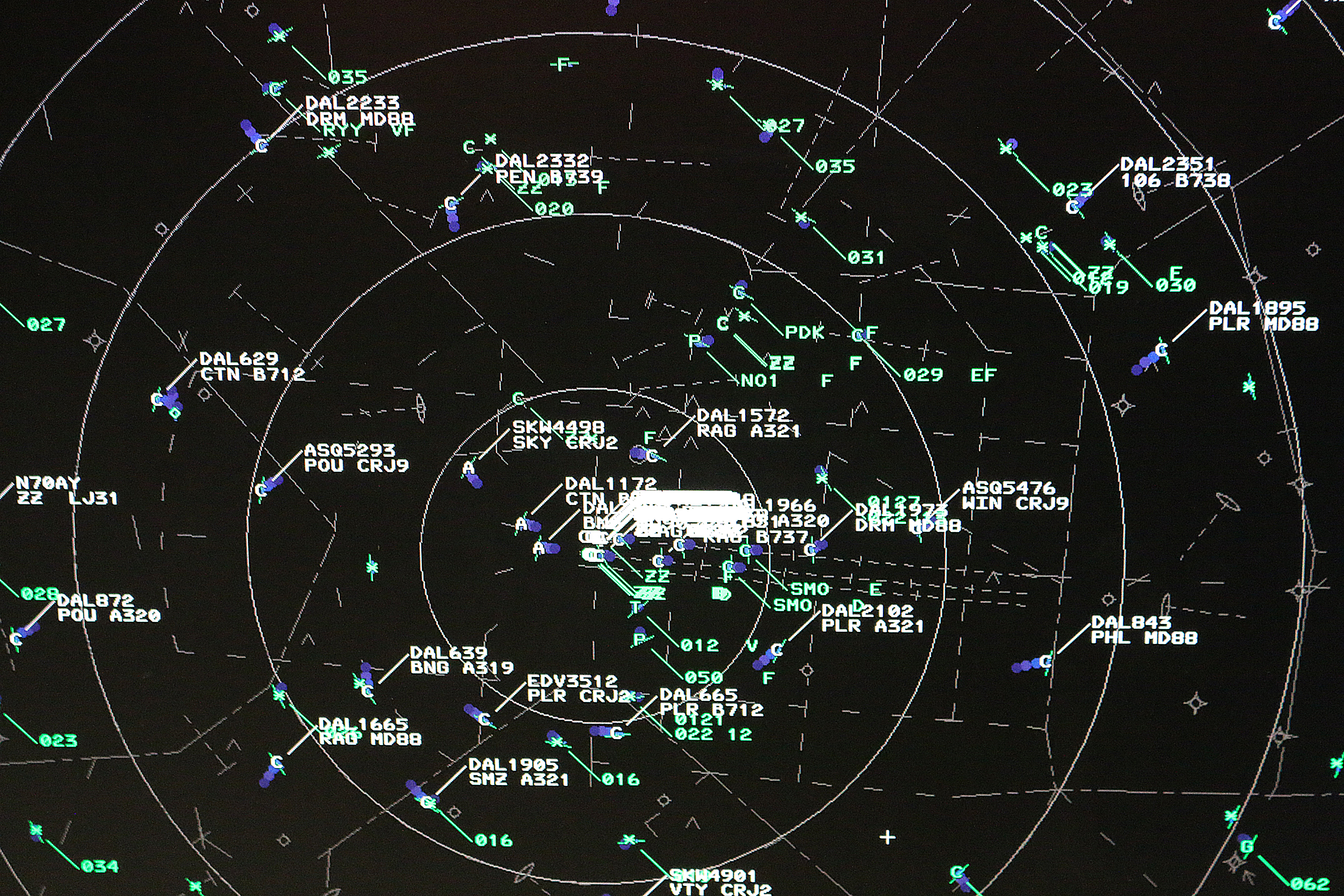
On the radar screen are blips which designate the locations of airplanes in the air near the airport and are identified with the airline, flight number and aircraft model. The information could contain altitude and ground speed in knots. The blip is covered with a letter — in this case, a letter C — indicating which air traffic controller is responsible for directing the aircraft. White type indicates the airplanes with which the air traffic controller is currently responsible; while green type indicates that a different air traffic controller is responsible for those aircraft.
Look closely at each blip and you can see the “trailing” which shows from which direction the aircraft is coming.
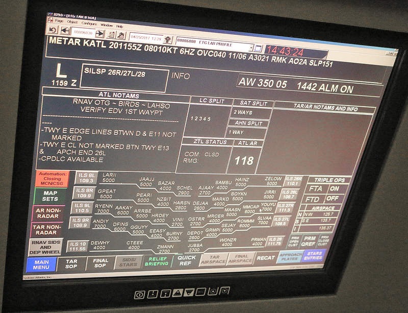
The overhead monitors display all sorts of information accessible by a control panel. The ILS is the instrument landing system, as referred in this article pertaining to test piloting a new Airbus A350 flight simulator. This screen displays aircraft at varying altitudes using the instrument landing system.
Safety and Security
The verbiage printed on the warning sign at the entrance to the building itself is intentionally dire when relating the possible consequences of visitors not complying with instructions.
Visitors are advised to deposit their visitor badges in a mailbox near the security checkpoint as they exit the facility — and if a visitor decides to keep the badge anyway, the printing is designed to purposely fade after a certain period so that the badge cannot be reused in the future.
Summary
Three photographs which were posted in this article have been removed at the request of the Federal Aviation Administration.
Tours of Terminal Radar Approach Control — or TRACON — facilities are free of charge; and 27 of these facilities currently exist in the United States. Tours must be booked several weeks in advance; and up to six visitors can be accompanied by one employee for the tour.
When visiting one of these facilities, bring your identification issued by a government entity — such as a driver’s license or passport. Expect to experience similar security measures as those conducted at airports — including the removal of your shoes, which for some reason I did not have to do — and portable electronic devices must be switched off for the duration of the tour.
A slide show presentation is shown to visitors in a conference room prior to the actual tour. Included in that presentation are videos of what air traffic looks like in 24 hours for both the world and the Atlanta area.
I found the tour to be fascinating; and I learned a lot from it.
All photographs ©2017 by Brian Cohen.
